New Maps for Majestic Bus Station, Bengaluru
Done at
(TYPE)
Information Design
Graphic Design
Design for Government
(CLIENTS)
Villgro, WRI India, BMTC
(MY ROLE)
Creative Lead, Design


(THE MISSION)
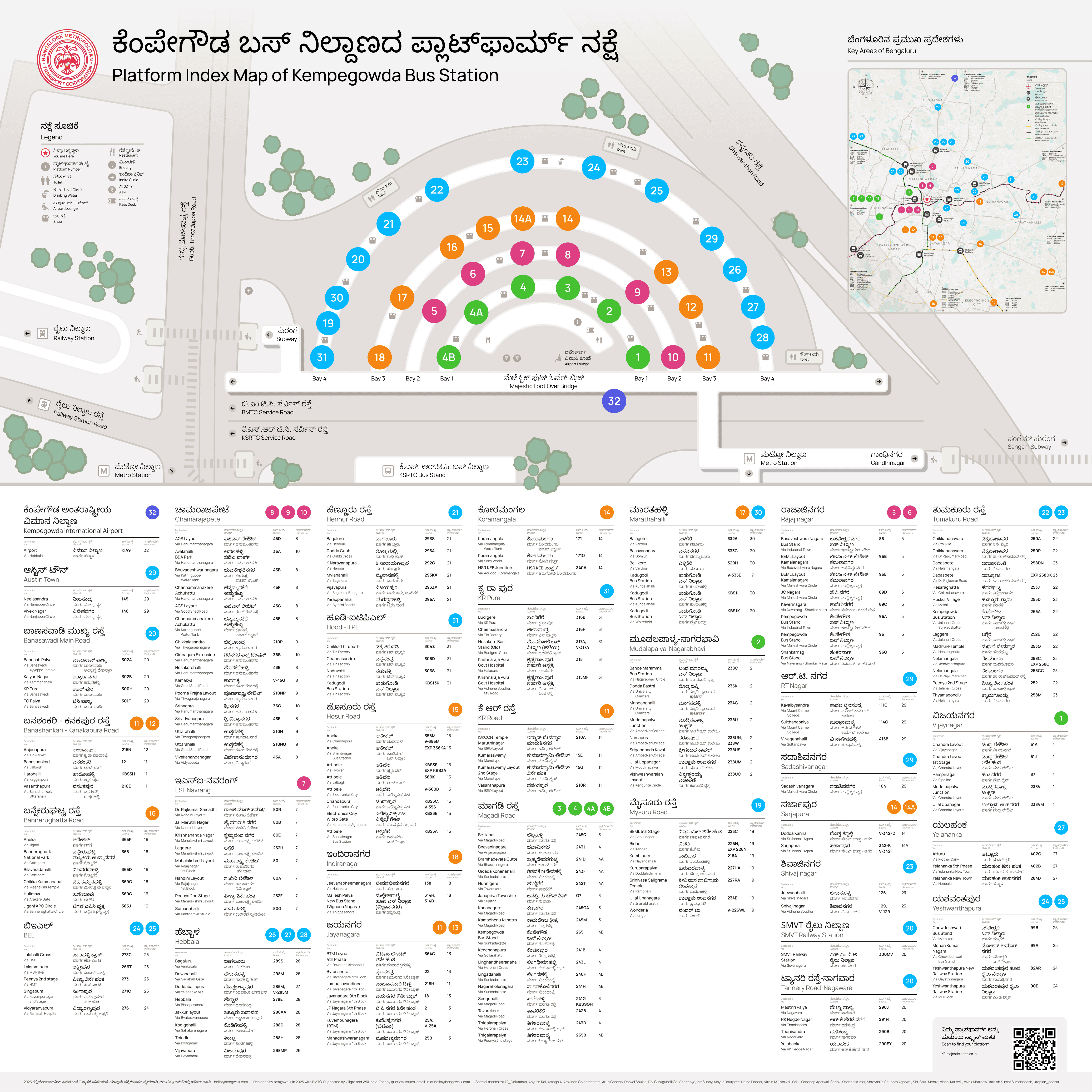
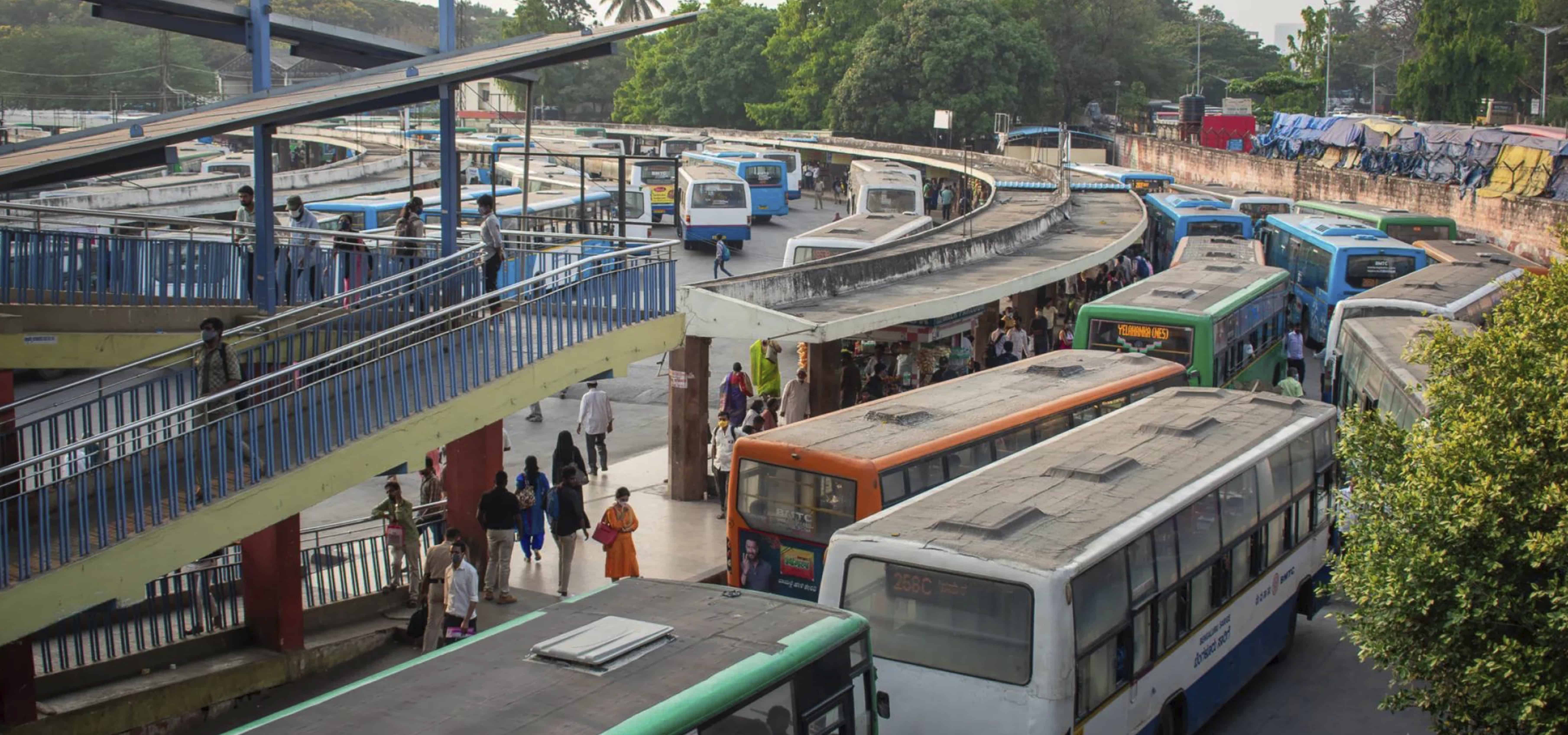
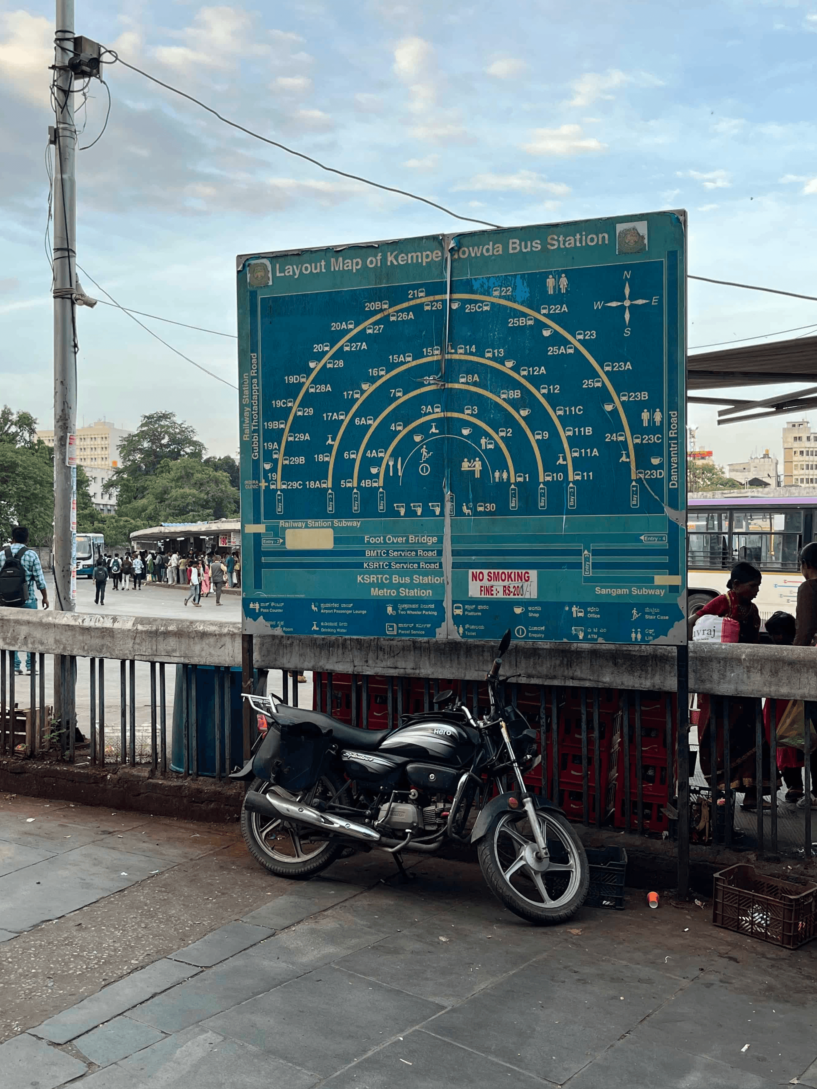
300+ frequent bus routes. 34 platforms across 4 bays. A neighbouring railway station. Now a metro interchange. Majestic is complex, to say the least.
(THE PROBLEM)

Which bus goes to Attibele?
Which platform does 126 go to?
Where’s the bus for SMVT?
(USER RESEARCH & SITE ANALYSIS)
We began on the ground to understand the current system of wayfinding at Majestic:
Spoke to 40+ commuters and did 10+ site visits
Observed commuter movement patterns and decision points
Mapped informal behaviors like asking for help, following crowds, and memorization


(Data Filtering & Categorisation)
The GTFS data (public transport data) was outdated. A lot of routes no longer existed. New ones were yet to be added. Not only did we clean and manually update it, we also filtered it by frequency and destination to get rid of redundancy.


(DESIGN SYSTEM)
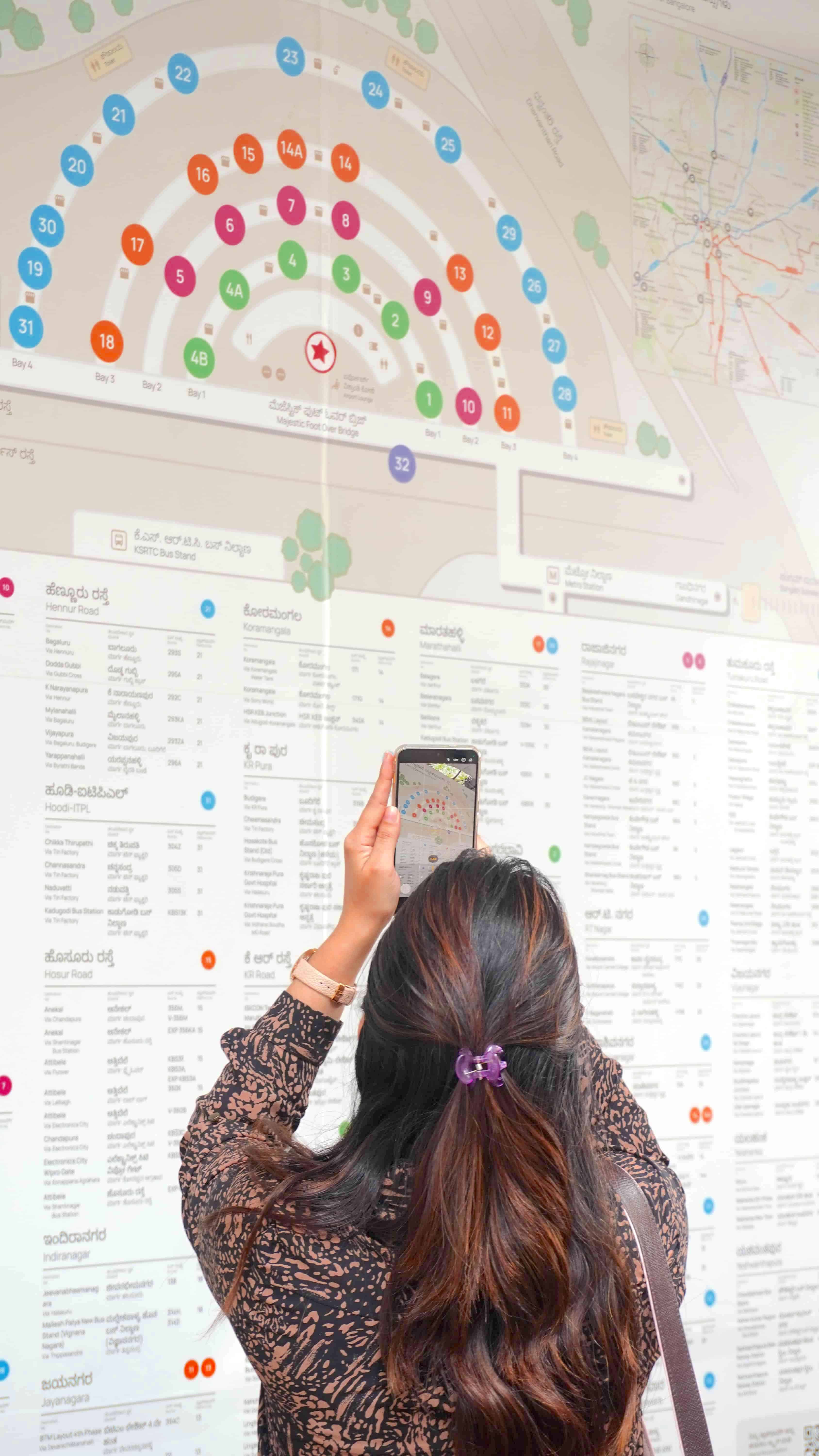
Some people look for their destination first. Some people search by bus number, some with the map view. Some use Kannada, some use English.
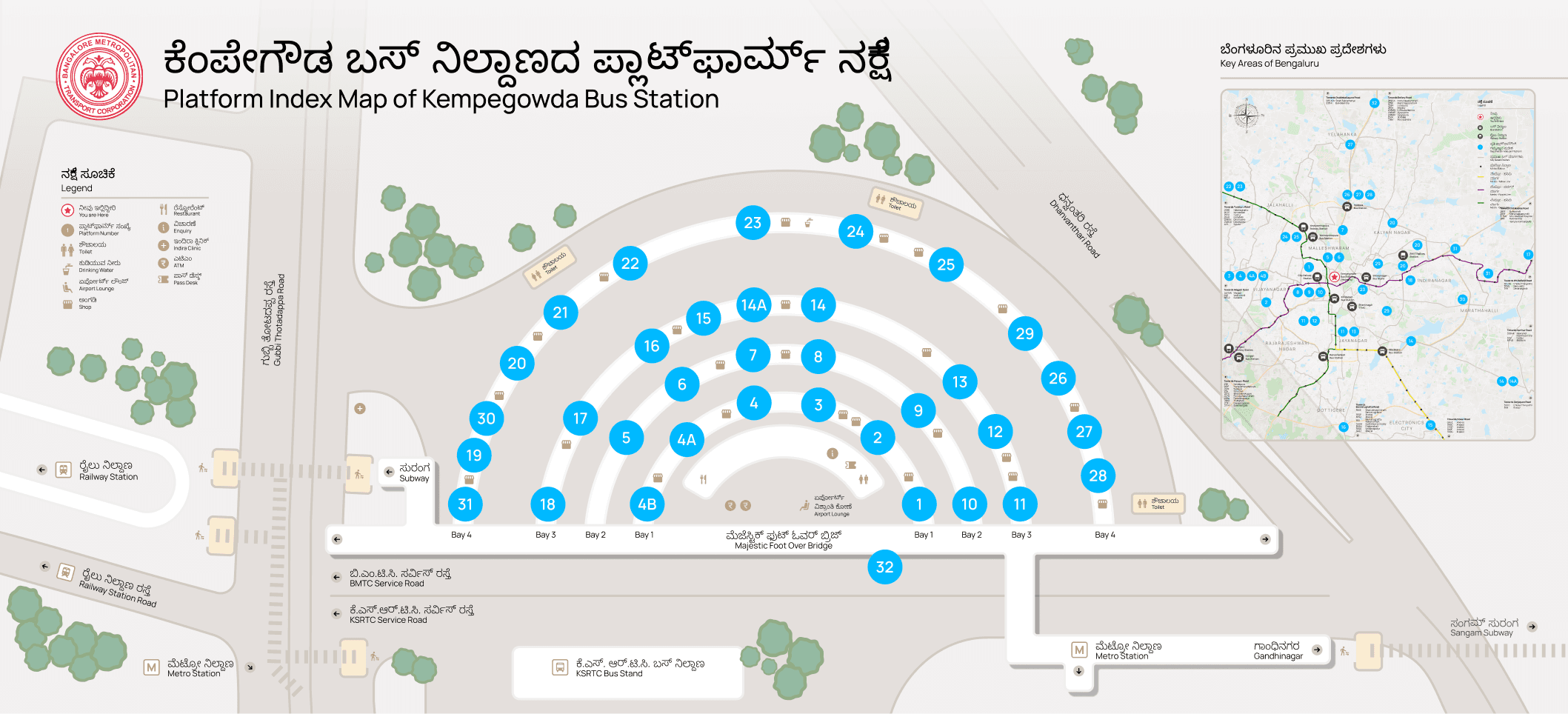
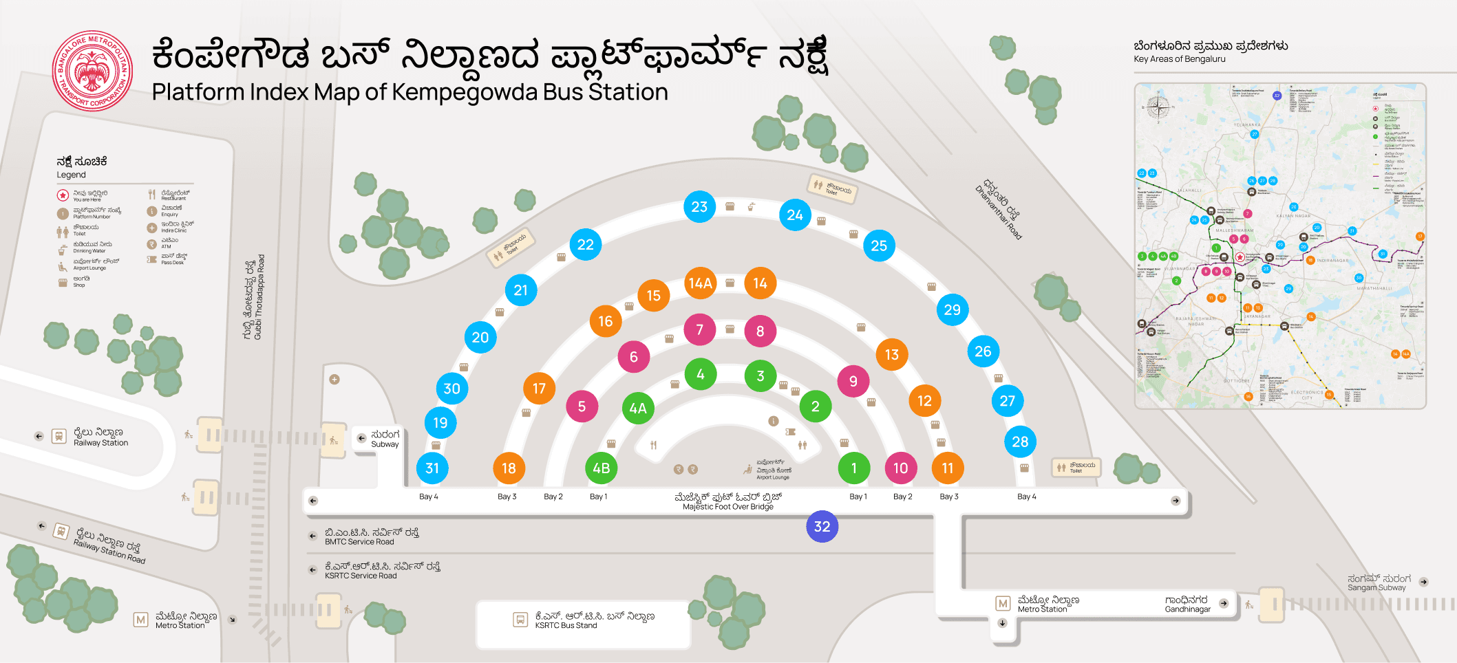
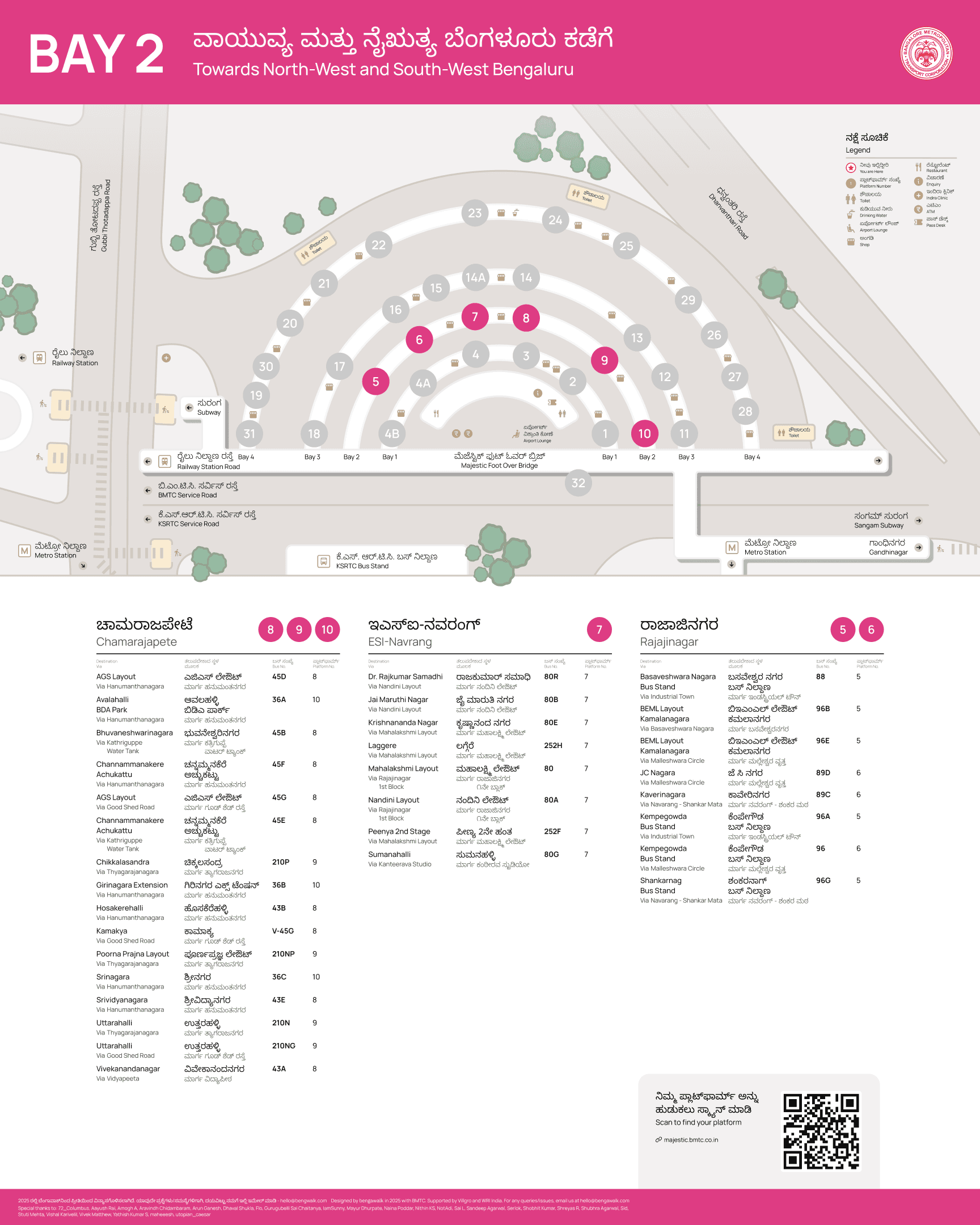
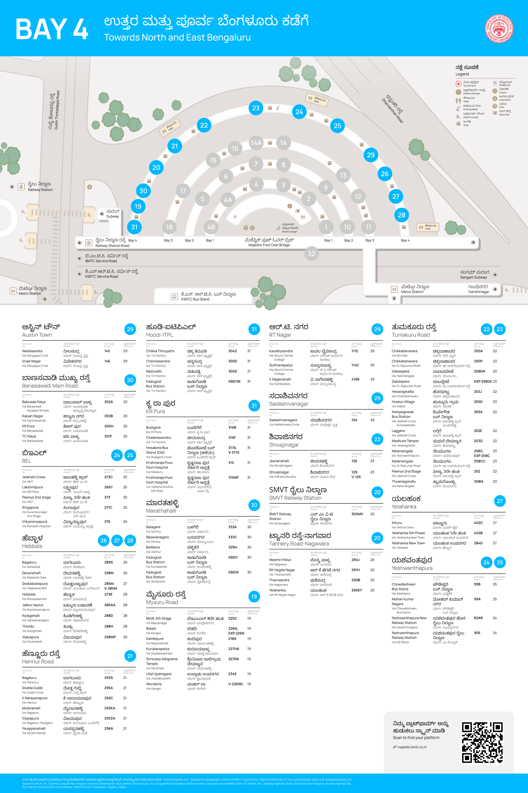
Sorting routes by designation areas instead of platform numbers
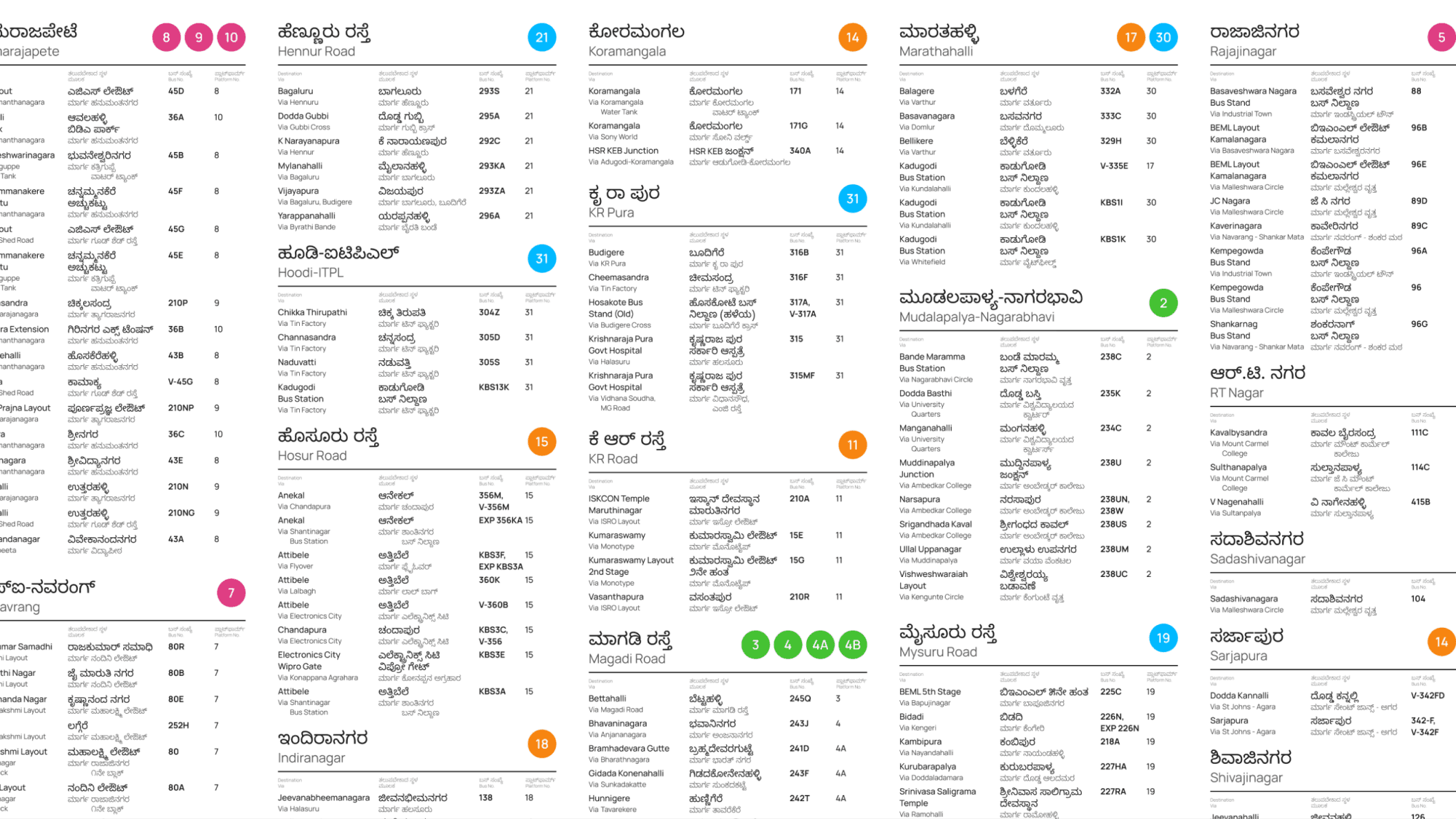
Sorting routes by designation areas instead of platform numbers
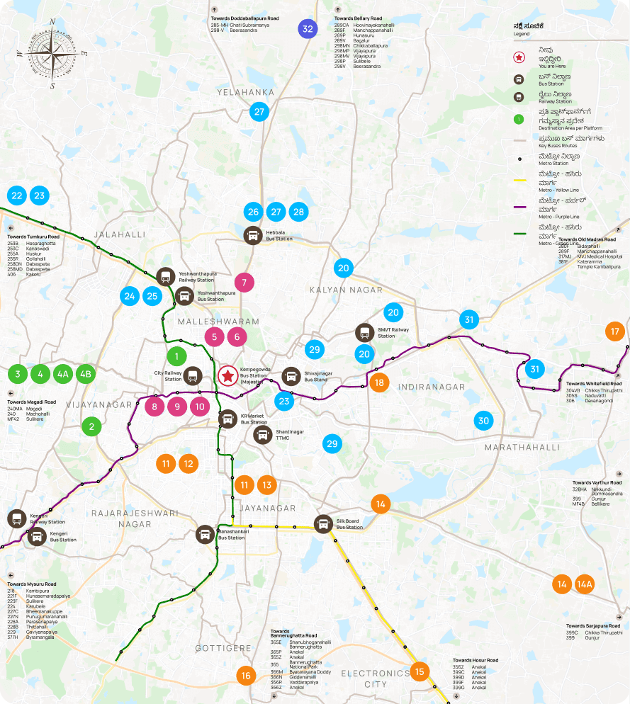
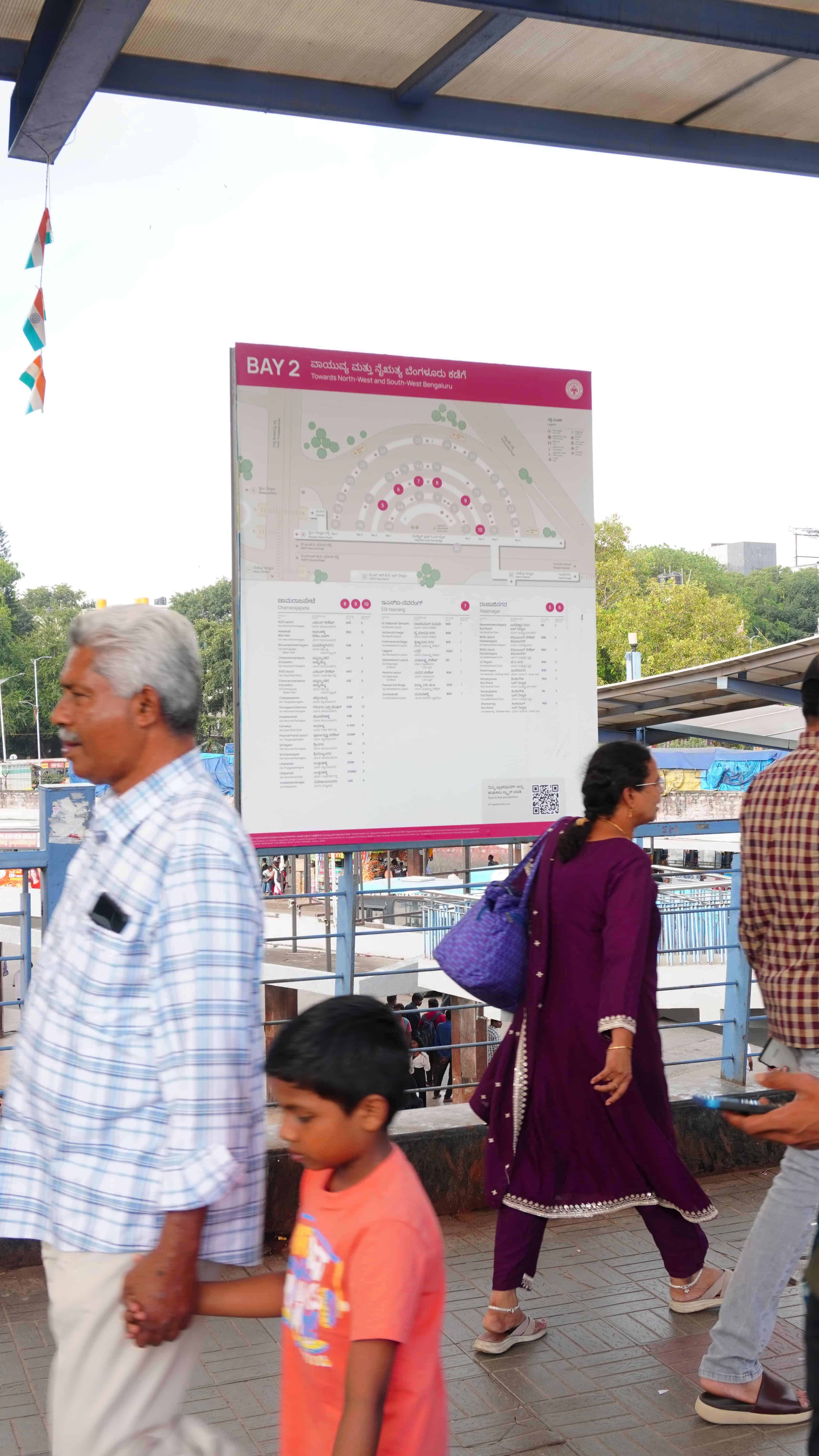
Secondary set of maps at the entrance of every bay
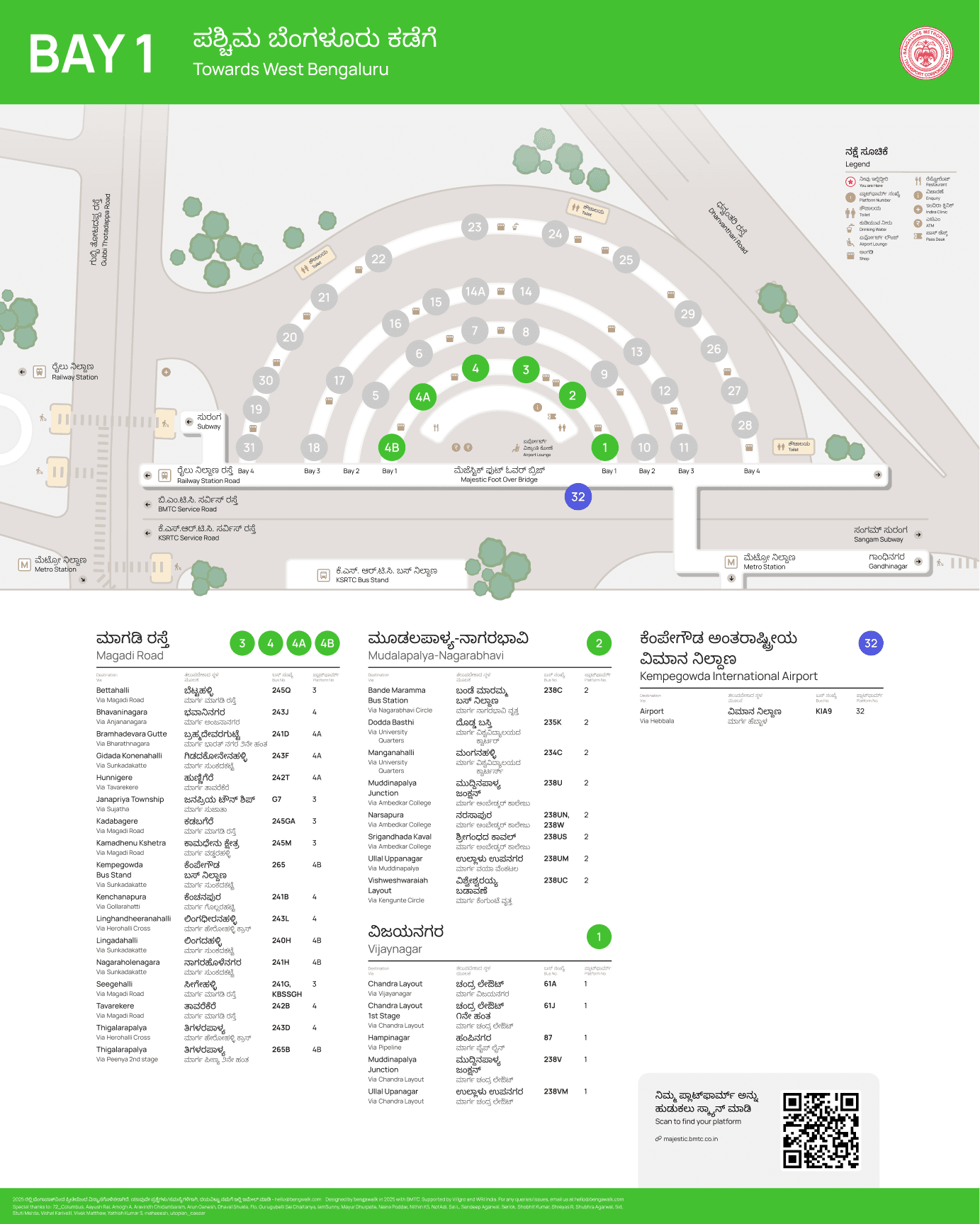
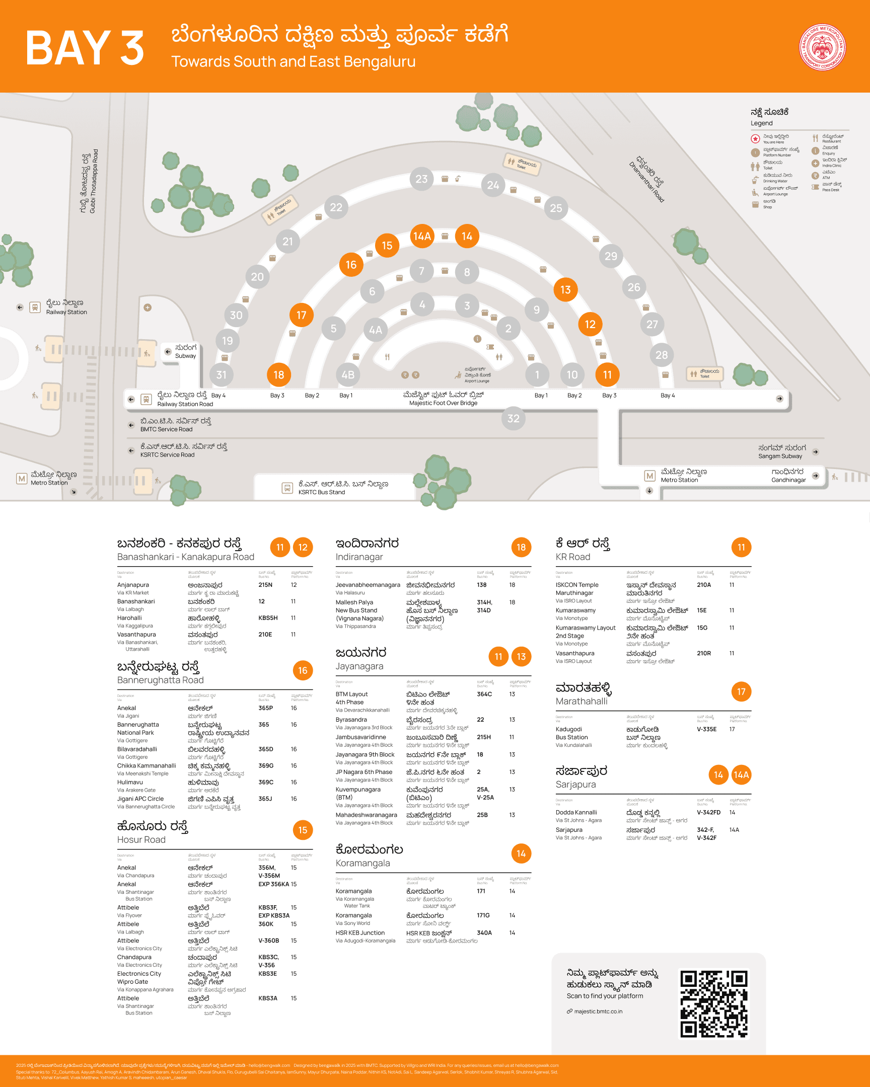
(DIGITAL)


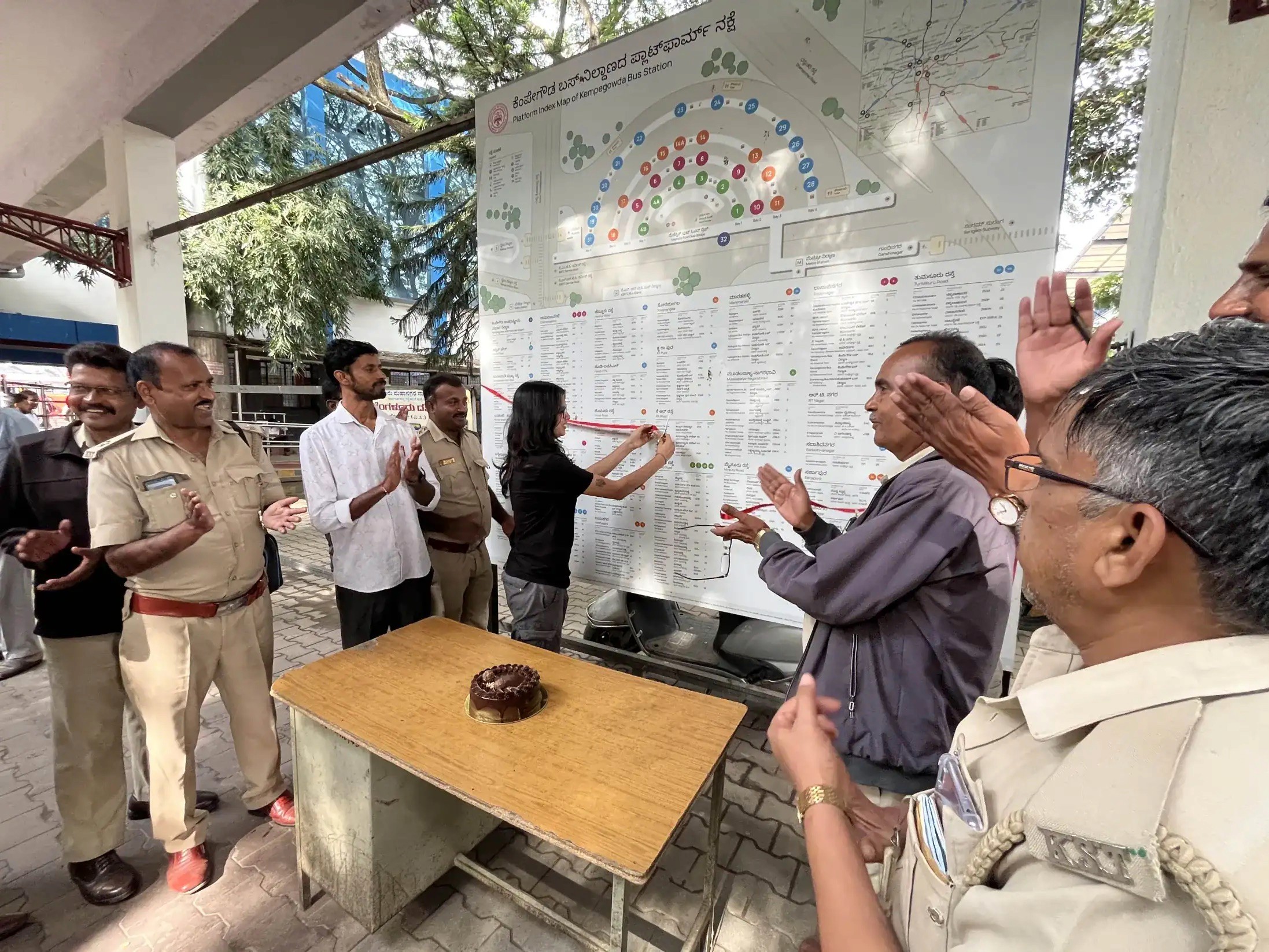
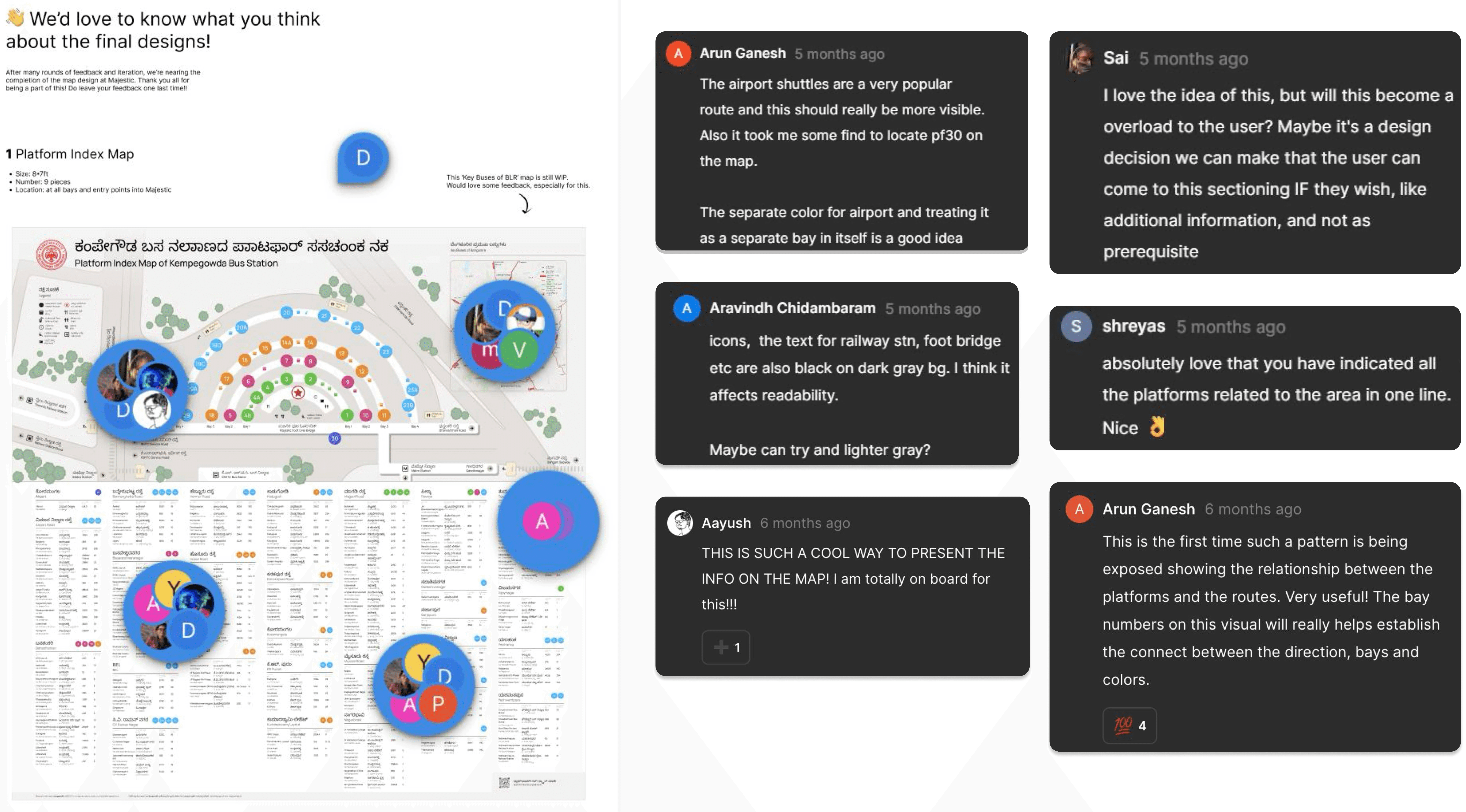
(PUBLIC FEEDBACK)
(IMPACT)